


United States Fact Cards
Original price
$9.95
-
Original price
$9.95
Original price
$9.95
$9.95
-
$9.95
Current price
$9.95
Digital Download
Enjoy instant access to your Montessori printables. This is a digital product - no physical items will be shipped.
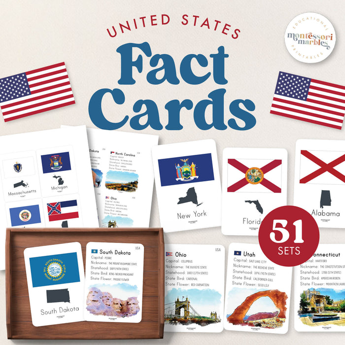
These United States fact cards help children ages 7 to 12 learn comprehensive information about all 50 states through double-sided nomenclature cards in this printable PDF format, perfect for elementary geography and American studies.
🇺🇸 WHAT'S INCLUDED
- 51 double-sided fact cards (50 states + Washington DC)
- 13 printable pages
- Card size: 3 in. x 4 in.
- State flag on front with map
- Comprehensive facts on back including capital, nickname, statehood date, state bird, state flower, and landmark
- Watercolor landmark illustrations
📚 SKILLS DEVELOPED
- United States geography knowledge
- State capitals and locations
- Reading comprehension and information retention
- Visual memory and association
- Research and independent study skills
- Cultural and historical understanding
- American civics foundations
✓ PERFECT FOR
- Ages 7-12 (elementary through middle school)
- 50 states geography units
- American history and civics education
- State reports and research projects
- Homeschool United States curriculum
- Social studies and geography centers
- Travel preparation and state exploration
- Montessori cultural studies
🗺️ EXPLORE MORE US GEOGRAPHY
- United States Flash Cards
- United States Nomenclature Cards
- North America Fact Cards
- Landmarks Flash Cards
