


European Countries Fact Cards
Digital Download
Enjoy instant access to your Montessori printables. This is a digital product - no physical items will be shipped.
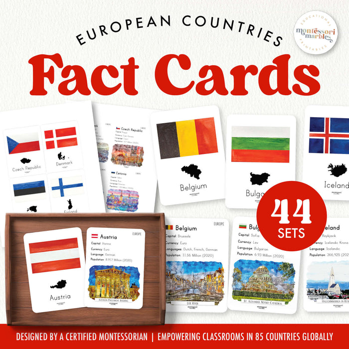
Students ages 6 to 12 explore all 44 European countries with this printable PDF fact card set featuring essential information about each nation's capital, population, official language, currency, and flag. This comprehensive geography resource supports research skills, cultural awareness, and independent study of the European continent through organized, at-a-glance country profiles.
📦 What's Included
- 44 country fact cards covering all European nations from Iceland to Malta
- Each card includes: country name, capital city, population, official language(s), currency, and flag image
- Organized presentation for easy reference and research
💡 Learning Benefits
- Build geography knowledge by learning European capitals, languages, and currencies
- Strengthen research and note-taking skills with organized fact presentations
- Develop cultural awareness by comparing populations, languages, and economic systems across countries
- Support independent continent study with accessible, child-friendly information
- Practice map skills by locating countries while referencing their fact cards
🎯 How to Use
- Print on cardstock and laminate for durability during repeated use
- Introduce 3-5 countries at a time rather than overwhelming students with all 44 cards
- Pair with a Europe puzzle map so children locate each country while reading its facts
- Encourage independent research by placing cards on a shelf alongside atlas and reference books
- Use cards to compare neighboring countries or regions like Scandinavia or the Balkans
- Create sorting activities by language family, currency type, or population size
🌍 Where This Fits in Geography Studies
Fact cards bridge the gap between basic continent recognition and deeper country-specific research. After children can identify Europe on a globe and name a few major countries, fact cards provide structured information for systematic continent exploration. This set works best when introduced alongside hands-on map work, not as isolated memorization. Offer fact cards after introducing the continents puzzle and before assigning independent country research projects.
🔗 Pair This With
- Animals of Europe Nomenclature Cards — discover European wildlife alongside country studies
- Continental Fact Cards Bundle — complete your world geography collection with all six continents
